Search Term Record
Metadata
Name |
Aerial |
Number of Photo records |
99 |
Related Records
-
2016.814.02 - Aerial - Ice Palace / Convention Hall
Aerial of Convention Hall and Ice Palace before the Arena was built.
Record Type: Photos Search
-
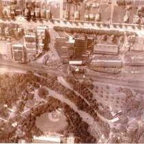
P-0004.10 - HOTEL HERSHEY / BUILDING
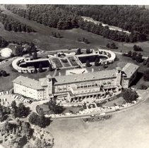
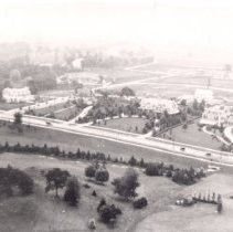
HOTEL HERSHEY BUILDING 11 - Aerial view of Hotel showing the approach to the Hotel, the reflecting pools and the swimming pool on the upper left side. The building next to the swimming pool, nearly hidden by trees is the golf course caddy house and shop - also food was served here for the golfers and the swimmers - the road encircles the Hotel; *
Record Type: Photos Search
-
P-0004.13 - HOTEL HERSHEY / BUILDING
HOTEL HERSHEY BUILDING 3,4,5,6,7,8 - A variety of aerial views of Hotel - shows the Hotel looking south to the town, looking north to the wooded area beyond the Hotel and other views of the Hotel property in detail; *
Record Type: Photos Search
-
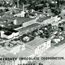
P-0013.11 - CHOCOLATE CO / CORP / FOODS - WINDOWLESS OFFICE
WINDOWLESS OFFICE 11 - Aerial view of the Chocolate Factory with the Windowless Office Building, the Community Building and the homes on Chocolate Avenue and Caracas Avenue across from the school playground in the1950's - the post office is the very small building on Chocolate Avenue on the left side of the photo;
Record Type: Photos Search
-
P-0022 - AERIAL / HERSHEY
AERIALS - HERSHEY 1 - Aerial - From Houses on Chocolate Avenue to the Arena - lower half of photo, beneath the railroad line - l-r - Park, baseball diamond, arena (at bottom edge of photo), Spring Creek with the fountain (circle in mid-stream), sunken gardens, dairy, ballroom - upper half - Houses on Chocolate Avenue from nearly Linden Road, Ridge Road just left of center, to Valley Road - Chocolate Avenue below houses - below Chocolate ...
Record Type: Photos Search
-
P-0022.01 - AERIAL / HERSHEY
AERIALS - HERSHEY 2 - Aerial view of the land surrounding the intersection of Cocoa Avenue and Fishburn Road where Hess Ford buildt their new Automobile dealership, now the Giant Grocery Store - Cocoa Avenue runs from left side of photo, up to meet Fishburn Road - the building that stands alone on Cocoa was the O'Neal farm, later where Stoessel 's was and then later became a sports bar called Yesterday's;
Record Type: Photos Search
-
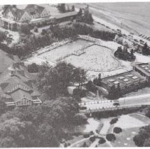
P-0022.03 - AERIAL / HERSHEY
AERIALS - HERSHEY 4 - Aerial of Park Golf Club, Swimming Pool, Sunken Gardens and Ballroom - the road above the Sunken Gardens is Park Boulevard;
Record Type: Photos Search
-
P-0022.04 - AERIAL / HERSHEY
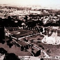
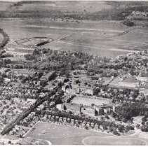
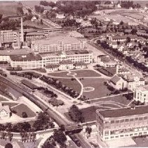
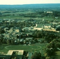
AERIALS - HERSHEY 5 - General view toward Hotel Hershey (at top of picture) to Memorial Field (at the bottom of the picture) - some identifiable buildings are Derry Township School on Granada Avenue, Community Building, Chocolate Factory, Cocoa Inn, Department Store, Arena, Stadium;
Record Type: Photos Search
-
P-0022.05 - AERIAL / HERSHEY
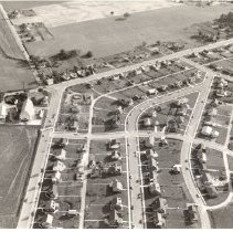
AERIALS - HERSHEY 20 - Cocoa Avenue & Governor Road in a 1960 photo - l-r - Streets - at bottom of photo - l-r - are Cocoa Avenue, an alley, Linden Road, Oak Lane - Crossing these roads, starting at the middle, Valley Road, Glenn Road - note that the barn and unit Brookside are at left on the corner of Cocoa Avenue and Governor Road now Crossroads Antiques - note also that several houses are being built at the curve of Cocoa and Governor - t...
Record Type: Photos Search
-
P-0022.09 - AERIAL / HERSHEY
AERIALS - HERSHEY 15,17 - Above the west end of Chocolate Avenue - l-r - is the Extraction Plant and Bus Garage (was the last trolley barn) and private homes, and below Chocolate Avenue are a few homes and the first Catholic Church, the School and the Convent in a 1949 photograph; 18 - 1949 photo of the middle-west end of Chocolate Avenue - above Chocolate Avenue, in the distance on the far left is the bathhouse of the swimming pool, th...
Record Type: Photos Search
-
P-0022.10 - AERIAL / HERSHEY
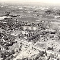
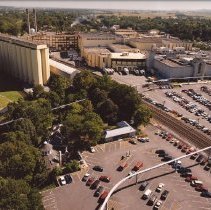
AERIALS - HERSHEY 14 - From south of Chocolate Avenue looking northwest with Park, Arena, Stadium, Milton Hershey School and Hotel Hershey in the background. In the foreground the Chocolate Factory, Power Plant, Cocoa Bean Silos and the Hershey Cocoa Bushes - note that the houses that were on the curve of Java Avenue have been torn down and now Homestead Road goes straight to Chocolate Avenue; *
Record Type: Photos Search
-
P-0022.11 - AERIAL / HERSHEY
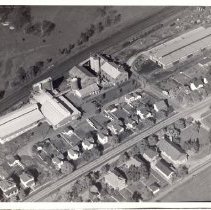
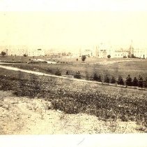
AERIAL - HERSHEY Various views ca 1900-1910; 21,22 - photo is difficult to identify; 23 - Railroad in center of photo, Fire House, Bank and Press Building are along the left edge; 24 - Railroad tracks intersecting Derry Road - The Derry Presbyterian Church is in the lower right of the photo;
Record Type: Photos Search
-
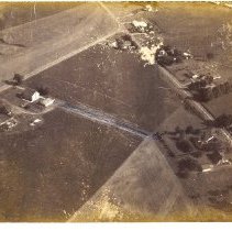
P-0022.12 - AERIAL / HERSHEY
AERIALS - HERSHEY 25 - Sand Beach covered bridge and surrounding area - the bridge burned down in 1936;
Record Type: Photos Search
-
P-0022.13 - AERIAL / HERSHEY
AERIALS - HERSHEY 26 - Looking east from Kissing Tower toward the Chocolate Factory and Silos; 27 - Looking north west from Kissing Tower - Park Avenue is at the lower right side of photo; 28 - Looking northeast from Kissing Tower - Park Avenue to the left side of photo; 29 - Looking south from Kissing Tower; 30 - Looking southwest from Kissing Tower - red building is the Hershey Laundry and the gray buil...
Record Type: Photos Search
-
P-0022.15 - AERIAL / HERSHEY
AERIALS - HERSHEY 16 - Early photograph (sometime before 1928) - looking east - to the left of railroad is the zoo, and the YWCA - on the right side of the railroad starting with the Factory and going clockwise along Chocolate Avenue is the Cafe, Fire Station, the Men's Club, the Bank, the Press Building, and the railroad station - on the right top along Chocolate Avenue, starting at the long building across from the Factory which is the ...
Record Type: Photos Search
-
P-0022.16 - AERIAL / HERSHEY
AERIALS - HERSHEY 33 - Aerial of Hershey from south of the School on Granada Avenue and Factory. The Park has expanded and has larger roller coasters and the Kissing Tower. The Parkview apartments are not in this photo and the new elementary school on Homestead Road is in lower part of photo; 34 - This photo is earlier, before the elementary school was built, the silos were built and Parkview apartments are still there;
Record Type: Photos Search
-
P-0197 - AERIAL / COUNTRY CLUB
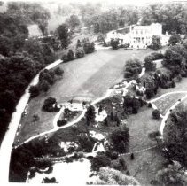
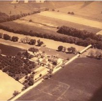
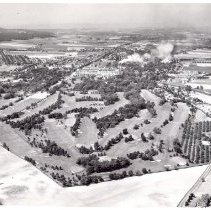
AERIAL VIEWS OF THE COUNTRY CLUB 2 - Country Club Golf Course - looking from east toward west, factory in background - The clubhouse was, at this time, in Mr. Hershey's Mansion with one green on his front lawn - the white roof of the mansion can be seen in the large group of trees just below the factory to the left of the smokestacks;
Record Type: Photos Search
-
P-0197.01 - AERIAL / COUNTRY CLUB
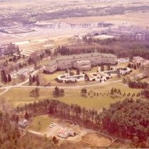
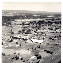
AERIAL VIEWS OF THE COUNTRY CLUB 1 - Country Club Golf Course - looking toward the northeast across Derry Road - This is the second home of the country club ( first opened on March 21, 1970) using a revised east course and a new west course for golf - the swimming pool is to the right of the club and the tennis courts are across Derry Road.
Record Type: Photos Search
-
P-0208 - AERIAL / HERSHEY - FROM FACTORY ROOF
AERIAL VIEWS OF HERSHEY FROM FACTORY ROOF 1,2 - Chocolate Avenue Mansions, looking southeast; 6 - Railroad and early zoo area - note the YWCA building (later the Parkview Apts) in the center of the photo - also, to the right of the YWCA is the Conservatory Building with the odd roof, seen surrounded by trees, and some Park building in the distance; 8 - Derry Road at railroad crossing at the left...
Record Type: Photos Search
-
P-0208.01 - AERIAL / HERSHEY - FROM FACTORY ROOF
AERIAL VIEWS OF HERSHEY FROM FACTORY ROOF 13 - M S Hershey Mansion property; 14 - Derry Road and Trinidad Avenue - note the Convention Hall on the upper left side of photo in the distance - it was also on Derry Road;
Record Type: Photos Search